I don't think the
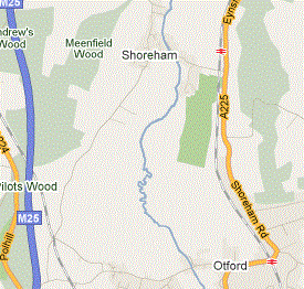
Open Street Map is very well known. It ought to be. It's a collaborative attempt to map the world on a shared, free basis. And I think the results are better than most. Here's a part of the world where I went cycling today. First, here's how Google maps sees it.
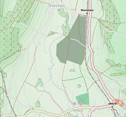
While here's the basic view from OSM:
There's simply more information - those red-dotted lines, for example, are footpaths, which Google doesn't show. (I also think it looks better - nicer fonts etc - but that's a personal preference.)
But the real strength of OSM is that users can select the information they want to include. Someone has used the OSM data to produce an
OpenCycleMap. Here's its version:
You can see how the roads are rendered differently - cyclists don't need to know that the road is the A225 - some information is left out, but some is included. You can't see it much on this extract, but it shows cycleroutes and - really important for cyclists - it shows contours.
The OSM project is a kind of wikipedia, and like wikipedia is only as good as the people who edit it. The perverse advantage OSM has is that you need a certain level of expertise to edit it, and to create specialised maps from the data. On the other hand, that means that certain parts of the world are poorly covered.
But, if you've got GPS equipment and want to fill in some of the gaps, it's probably not that difficult. Why not try it?


1 comment :
Thanks for this link, very interesting, though Google Maps still has an edge with the rather scary satellite view. Mal
Post a Comment